Google Maps Discovery Leads Scientists to a 390-Million-Year-Old Meteor Impact Crater in Canada
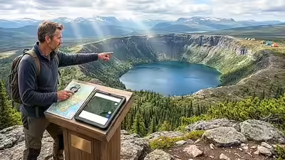
Planning a camping trip usually ends with choosing a destination. For one Canadian resident, it led to something far more unusual—a geological discovery that has drawn the attention of scientists.
A circular formation spotted on Google Maps in a remote part of Quebec has now been identified by researchers as an ancient meteor impact crater estimated to be around 390 million years old. The discovery highlights how publicly available satellite imagery and citizen observations can sometimes contribute to scientific research.
What Happened?
The discovery began when Canadian resident Joël Lapointe noticed an unusually circular landform while exploring Google Maps to plan a camping trip in Quebec.
The shape appeared different from the surrounding landscape, prompting him to contact experts rather than dismiss it as a mapping anomaly. His observation eventually reached researchers specializing in planetary geology, who launched a scientific investigation.
After examining satellite images, geological maps and conducting fieldwork at the remote location, researchers concluded that the site displays strong characteristics of an ancient meteor impact crater estimated to be about 390 million years old.
How Credible Is This Discovery?
The finding is supported by researchers who visited the location and collected geological evidence, making it much more than an internet claim or social media speculation.
However, scientists have also emphasized that additional laboratory analysis and peer-reviewed research are still needed before the crater’s age and origin can be considered fully confirmed. The research is expected to be presented to the wider scientific community, where it will undergo further scrutiny.
Why Does This Matter?
Meteor impact craters provide valuable information about Earth’s geological history and the evolution of the planet over hundreds of millions of years.
Many ancient craters disappear over time because of erosion, tectonic activity and natural weathering. Discovering a previously unknown impact structure can help scientists better understand:
- Earth’s history of meteor impacts
- Geological changes over millions of years
- The composition of ancient rocks
- How large impacts have shaped landscapes
Such discoveries also improve scientific databases used by researchers studying planetary geology and impact events across Earth and other planets.
The Role of Google Maps and Citizen Science
One of the most interesting aspects of this story is that the discovery did not begin inside a research laboratory.
Instead, it started with an ordinary person using freely available satellite imagery.
This demonstrates the growing importance of “citizen science”—where members of the public contribute observations that may later become valuable scientific findings. Modern satellite mapping platforms allow millions of people to observe remote areas that would otherwise receive little attention.
Experts note, however, that unusual shapes seen from space are not automatically meteor craters. Many circular formations are created by volcanic activity, erosion or other natural geological processes, which is why field verification remains essential.
Who Benefits From This Discovery?
Several groups could benefit from the research.
Scientific community
- Gains another potential site for studying ancient impact events.
- May improve understanding of Earth’s geological evolution.
Educational institutions
- Can use the discovery as a real-world example of geological research and remote sensing.
Local region
- The site may attract scientific expeditions and educational interest if future studies confirm its significance.
At this stage, there are no known negative economic or environmental impacts directly linked to the discovery.
Could This Lead to Bigger Changes?
The discovery is unlikely to change public policy immediately, but it may encourage greater use of satellite imagery in geological research.
It also reinforces the value of collaboration between amateur observers and professional scientists. As satellite mapping tools become more detailed, researchers may receive more reports of unusual landforms from members of the public.
Still, experts caution that every potential discovery requires rigorous scientific investigation before conclusions are drawn.
How Are Scientists Responding?
Researchers involved in the investigation have described the finding as scientifically significant while remaining cautious about final conclusions.
Their approach reflects standard scientific practice: observations are followed by field studies, laboratory analysis and peer review before a discovery is fully accepted.
The broader scientific community is expected to evaluate the evidence once the research is formally presented and published.
What Should Readers Expect Next?
Further geological testing is expected to continue.
Scientists will likely analyze additional rock samples and compare the site with other known impact structures. If future studies support the current findings, the crater could become an officially recognized addition to Canada’s list of meteor impact sites.
Until then, researchers consider the available evidence promising but continue to treat the investigation as an ongoing scientific process.
Key Takeaways
- A Canadian man’s observation on Google Maps led scientists to investigate a remote circular landform in Quebec.
- Researchers believe the site represents a meteor impact crater dating back roughly 390 million years, although additional scientific verification is still underway.
- The discovery demonstrates how modern mapping technology and careful public observation can contribute to meaningful scientific research when supported by rigorous investigation.